Progress in biodiversity monitoring in Northern Ghana
This blog, prepared by Charles Lamoussa Sanou, Leonard Akoba, and Kwame Oppong Hackman, shares insights from a recent COINS Project field mission conducted from January 20–25, 2025, in the Tolon District of Northern Ghana. The aim is to shed light on biodiversity monitoring efforts in the region and to share key findings with stakeholders involved in Sustainable Land Management (SLM). The blog summarises the biodiversity monitoring methods applied by the WASCAL team, highlighting their relevance and contribution to sustainable land use practices in smallholder farming systems.
Above and below ground biodiversity was monitored across three land use types: Integrated Soil Fertility Management (ISFM), conventional, and less disturbed landscape as a proxy of pristine area. Arthropods are central to the monitoring due to their role as indicators of ecological health across different landscapes, including the pristine and agricultural landscapes.
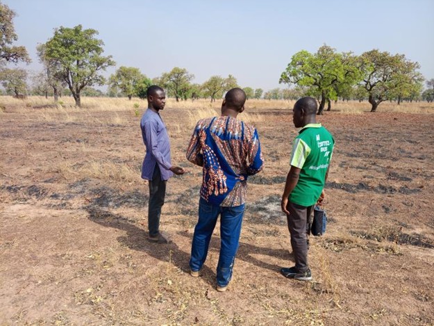
WASCAL team field visit
The team visited nine sites comprising three (3) less disturbed areas (proxy to pristine area), three (3) ISFM and three (3) conventional land-use areas to observe the conditions under which the biodiversity monitoring data was collected. Recommendations were made to the PhD fellow to thoroughly describe each site’s characteristics, including climate, vegetation, and soil composition. Notably, the pristine (i.e., less disturbed) areas were found to be rocky, which makes them unsuitable for farming. However, they undergo anthropogenic activities such as livestock grazing, bushfires, and fuelwood extraction, which may impact biodiversity.
WASCAL team in discussion with the field assistant on a burnt ISFM site
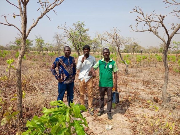
WASCAL team and the PhD fellow in the middle in a less disturbed (i.e., pristine) land use
The WASCAL team and the two local supervisors.
PhD fellow supervision team meeting
A productive exchange was held with local supervisors regarding the PhD fellow’s current achievements. The research objectives and comprehensive methodology are discussed. In the perspective of enhancing the ongoing research, emphasis was made on underground biodiversity monitoring, with recommendations to extend the analysis to include soil micro-organisms beyond those visible to the naked eye. Additionally, the discussion focused on extrapolating ISFM results across larger areas where sampling had not been conducted, utilising satellite imagery. Finally, the team went to inspect the collected biodiversity data, discussed the sorting and counting process, and provided feedback to the student.
Lessons learned
Fire burning was observed during the fallow period in both ISFM and conventional fields, indicating ongoing disturbance regardless of management practice. Additionally, the selected less disturbed area, used as a proxy for a pristine area, continues to experience disturbances from fire burning, livestock grazing, and fuel wood extraction.
To provide the best experiences, we use technologies like cookies to store and/or access device information. Consenting to these technologies will allow us to process data such as browsing behavior or unique IDs on this site. Not consenting or withdrawing consent, may adversely affect certain features and functions.
Functional
Always active
The technical storage or access is strictly necessary for the legitimate purpose of enabling the use of a specific service explicitly requested by the subscriber or user, or for the sole purpose of carrying out the transmission of a communication over an electronic communications network.
Preferences
The technical storage or access is necessary for the legitimate purpose of storing preferences that are not requested by the subscriber or user.
Statistics
The technical storage or access that is used exclusively for statistical purposes.The technical storage or access that is used exclusively for anonymous statistical purposes. Without a subpoena, voluntary compliance on the part of your Internet Service Provider, or additional records from a third party, information stored or retrieved for this purpose alone cannot usually be used to identify you.
Marketing
The technical storage or access is required to create user profiles to send advertising, or to track the user on a website or across several websites for similar marketing purposes.